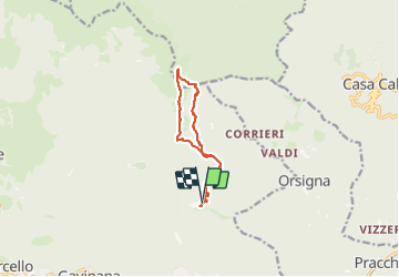
![](/images/other/stat-length.png)
![Tour Wandern San Marcello Piteglio - Rifugio Casetta Pulledrari - Monte Gennaio - Photo](https://media.geolcdn.com/t/1900/400/436dedab-1c44-4626-b1e0-e746cc9c51ee.jpg&format=pjpeg&maxdim=2)
Rifugio Casetta Pulledrari - Monte Gennaio
Elis Barbieri - Crb
Benutzer
![Länge](/images/other/stat-length.png)
![Maximale Höhe](https://static1.geolcdn.com/siteimages/upload/files/1508320355ic_sort_altitude_max_24dp.png)
![Positive Höhendifferenz](https://static1.geolcdn.com/siteimages/upload/files/1508320355ic_sort_den_pos_24dp.png)
![Km-Effort](/images/other/stat-length.png)
![Min. Höhe](https://static1.geolcdn.com/siteimages/upload/files/1508320355ic_sort_altitude_min_24dp.png)
![Negative Höhendifferenz](https://static1.geolcdn.com/siteimages/upload/files/1508320355ic_sort_den_neg_24dp.png)
![Boucle](https://static1.geolcdn.com/siteimages/upload/files/16400158638029165_repeat_loop_refresh_sync_direction_icon.png)
![Wandern](https://static1.geolcdn.com/sitytour/trail-icons/101.png)
5h28
Schwierigkeit : Einfach
![Scannen Sie diesen QR-Code, um die Tour in der SityTrail-Anwendung zu öffnen](https://capi.geolives.com/qq0zvz2zws4bq2lad0pu/sitytour/trails/3789440/qr.png?size=200)
Kostenlosegpshiking-Anwendung
Über SityTrail
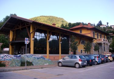
Tour Wandern von 11,2 km verfügbar auf Toskana, Pistoia, San Marcello Piteglio. Diese Tour wird von Elis Barbieri - Crb vorgeschlagen.
Beschreibung
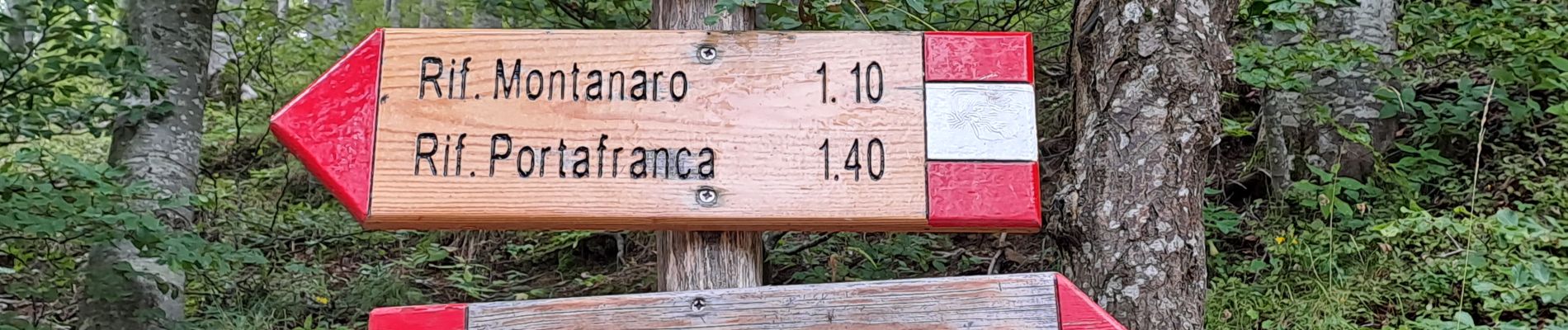
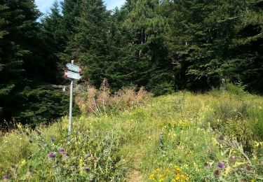
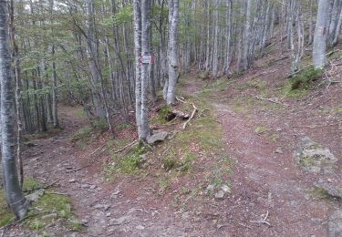
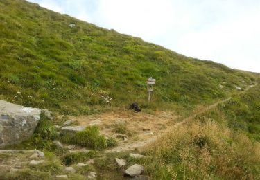
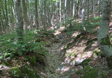
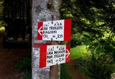
Belle rando pour tous, sans grandes difficultés mais très agréable et avec des points de vue splendides. Pour les plus chanceux que nous, le sentier continue par la crête jusqu'au sommet du Gennaio, cela rajoute 2km et une bonne centaine de mètres de D avec une belle grimpette, nous avons dû y renoncer à cause de la météo. Plusieurs refuges sont présents le long du chemin.
Ort
Kommentare
Touren in der Umgebung
![Tour Zu Fuß Pistoia - (SI L13) Pracchia - Lago Scaffaiolo - Photo](https://media.geolcdn.com/t/375/260/0f01b9d8-449a-4075-bdb2-32152f2e40dd.jpeg&format=jpg&maxdim=2)
![Zu Fuß Zu Fuß](https://static1.geolcdn.com/sitytour/trail-icons/100.png)
Zu Fuß
![](/images/other/stat-length.png)
![](https://static1.geolcdn.com/siteimages/upload/files/16400158638029165_repeat_loop_refresh_sync_direction_icon.png)
![Tour Zu Fuß Pistoia - Itinerario Pracchia-Abetone - Photo](https://media.geolcdn.com/t/375/260/e45850ca-9d49-4aba-bfa8-b4751d84c6db.jpeg&format=jpg&maxdim=2)
![Zu Fuß Zu Fuß](https://static1.geolcdn.com/sitytour/trail-icons/100.png)
Zu Fuß
![](/images/other/stat-length.png)
![](https://static1.geolcdn.com/siteimages/upload/files/16400158638029165_repeat_loop_refresh_sync_direction_icon.png)
![Tour Zu Fuß San Marcello Piteglio - CAI 1 PT - Maresca - Maceglia - Photo](https://media.geolcdn.com/t/375/260/5971676b-e756-4d4b-bda8-f4f8638d99ce.jpeg&format=jpg&maxdim=2)
![Zu Fuß Zu Fuß](https://static1.geolcdn.com/sitytour/trail-icons/100.png)
Zu Fuß
![](/images/other/stat-length.png)
![](https://static1.geolcdn.com/siteimages/upload/files/16400158638029165_repeat_loop_refresh_sync_direction_icon.png)
![Tour Zu Fuß Alto Reno Terme - IT-141 - Photo](https://media.geolcdn.com/t/375/260/837c7b1e-4426-4052-bd2b-49b56b8e1396.jpeg&format=jpg&maxdim=2)
![Zu Fuß Zu Fuß](https://static1.geolcdn.com/sitytour/trail-icons/100.png)
Zu Fuß
![](/images/other/stat-length.png)
![](https://static1.geolcdn.com/siteimages/upload/files/16400158638029165_repeat_loop_refresh_sync_direction_icon.png)
![Tour Zu Fuß Alto Reno Terme - IT-143 - Photo](https://media.geolcdn.com/t/375/260/9792fc3a-d6cb-463b-947b-822721eca185.jpeg&format=jpg&maxdim=2)
![Zu Fuß Zu Fuß](https://static1.geolcdn.com/sitytour/trail-icons/100.png)
Zu Fuß
![](/images/other/stat-length.png)
![](https://static1.geolcdn.com/siteimages/upload/files/16400158638029165_repeat_loop_refresh_sync_direction_icon.png)
![Tour Zu Fuß San Marcello Piteglio - Maresca - Passo dei Malandrini - Photo](https://media.geolcdn.com/t/375/260/5971676b-e756-4d4b-bda8-f4f8638d99ce.jpeg&format=jpg&maxdim=2)
![Zu Fuß Zu Fuß](https://static1.geolcdn.com/sitytour/trail-icons/100.png)
Zu Fuß
![](/images/other/stat-length.png)
![](https://static1.geolcdn.com/siteimages/upload/files/16400158638029165_repeat_loop_refresh_sync_direction_icon.png)
![Tour Zu Fuß Pistoia - Orsigna - Fonte dell'Uccelliera - Photo](https://media.geolcdn.com/t/375/260/e6c0d80e-04db-46ff-b8f8-51515e0675c8.jpeg&format=jpg&maxdim=2)
![Zu Fuß Zu Fuß](https://static1.geolcdn.com/sitytour/trail-icons/100.png)
Zu Fuß
![](/images/other/stat-length.png)
![](https://static1.geolcdn.com/siteimages/upload/files/16400158638029165_repeat_loop_refresh_sync_direction_icon.png)
![Tour Wandern San Marcello Piteglio - Rifugio Casetta Pulledrari - Monte Gennaio - version facile - Photo](https://media.geolcdn.com/t/375/260/daaff453-edd6-4107-be4f-abc97a0b9c78.jpg&format=jpg&maxdim=2)
![Wandern Wandern](https://static1.geolcdn.com/sitytour/trail-icons/101.png)
Wandern
![](/images/other/stat-length.png)
![](https://static1.geolcdn.com/siteimages/upload/files/16400158638029165_repeat_loop_refresh_sync_direction_icon.png)
![Tour Zu Fuß Alto Reno Terme - IT-145 - Photo](https://media.geolcdn.com/t/375/260/079bc68d-d89b-4e9f-a559-5b432440ed95.jpeg&format=jpg&maxdim=2)
![Zu Fuß Zu Fuß](https://static1.geolcdn.com/sitytour/trail-icons/100.png)
Zu Fuß
![](/images/other/stat-length.png)
![](https://static1.geolcdn.com/siteimages/upload/files/16400158638029165_repeat_loop_refresh_sync_direction_icon.png)